Comments on the management plan for Retezat National Park
To:
Retezat National Park Administration — for the attention of the management-plan drafting team
For information:
National Agency for Protected Natural Areas (ANANP)
Ministry of Environment, Waters and Forests (MMAP)
Comments
on the MANAGEMENT PLAN FOR RETEZAT NATIONAL PARK, INCLUDING THE RESERVES 2.494 GEMENELE, 2.496 PEȘTERA ZEICULUI, TOGETHER WITH THE PARTIALLY OVERLAPPING NATURA 2000 SITES — ROSCI0217 RETEZAT and ROSPA0084 MUNȚII RETEZAT
Contents
2.1 Organisation and structure: 4
2.2 Authors and legal responsibility: 4
2.3 Compliance with European directives: 5
2.4 Compliance with the legal boundaries of protected areas: 5
2.5 Compliance with previous scientific justifications and legal provisions: 6
2.5.5 Full compliance with the provisions of Art. 22 (paragraphs 1,2 and 4) of OUG 57/2007. 11
2.5.6 Compliance with the Pin Matra and PRIMOFARO studies. 16
2.5.7 Compliance with the purpose of the national park 16
2.5.8 Compliance with Law 2013/1998. 16
2.6 Correct and complete drafting of the document: 16
3.1 ANNEX 1_ Distribution of Stands in the Râul Șes Basin. 24
3.2 ANNEX 2_catalogue of virgin and quasi-virgin forests 16 November 2020. 24
3.4 ANNEX 4_Specifications-virgin-forests. 24
We, the undersigned, Asociația Agent Green, Asociația Altitudine and Călin Dejeu, biologist and environmental activist, as stakeholders in the conservation of the valuable ecosystems in Retezat National Park, submit the following comments on the drafting of the Management Plan for Retezat National Park:
1 Requests
Following the major shortcomings identified and set out below, we request the following:
- Establishing non-intervention throughout the national park and excluding the establishment of a sustainable conservation zone or a sustainable management zone, except on built-up land
- Establishing the strict protection zone in wild areas where there has been no human intervention or its level has been very low.
- Redoing certain deficient studies on species, habitats and pressures
- Making available to stakeholders all studies, cartographic materials and vectors resulting from the project “Strengthening capacity for the adaptive management of natural capital in the protected areas of Retezat National Park, including the reserves 2.494 Gemenele, 2.496 Peștera Zeicului, together with the partially overlapping Natura 2000 sites — ROSCI0217 Retezat and ROSPA0084 Munții Retezat, SMIS code 116950.
- Establishing concrete restoration measures for all biotic and abiotic factors affected/degraded by logging or other activities.
- Redrafting the management plan in its entirety.
- Redrafting the Regulations in their entirety.
- Restarting public consultations from the beginning, presenting all information, studies, detailed maps, etc. for consultation.
If our constructive comments and proposals concerning the future management plan for Retezat National Park are disregarded without any real reason, and we subsequently find discrepancies between the classification of forests in the national park and the Retezat Natura 2000 site and the actual situation on the ground, and the park does not benefit from strict, 100% protection, as Romania’s first national park and a national symbol, we will reserve the right to challenge the management plan subsequently in court and to report these matters to international institutions and bodies (European Commission, IUCN).
Given that you have exceeded the two-year deadline laid down by law, the Ministerial Order and the administration contract for approving the management plan, and that, consequently, the administration contract is null and void by operation of law, please inform us in what capacity you accessed the European funding and are continuing to draft the plan.
2 Shortcomings
2.1 Organisation and structure:
- Presenting information according to the structure established by the Ministry of Environment. The management plan does not follow the structure of the Guide for drafting management plans for protected natural areas of 02.04.2018, approved by Order of the Minister of Environment No. 304/2018. For this reason, the entire management plan must be completely redrafted and the whole procedure restarted.
- Preparing an integrated management plan in accordance with the provisions of OUG57/2007 and the administration contract.
2.2 Authors and legal responsibility:
- specifying the authors and each person’s concrete contribution. The current management plan is an anonymous document for which no expert takes responsibility. A list of the drafters must be presented for each chapter of both the written and graphical parts.
- Outdated or irrelevant bibliographical sources. The bibliography contains an “inventory” of works published from the 1930s to around 2016, but these have no relevance to the drafting of the plan, since the text contains no paragraph cited from that bibliography. This even raises suspicions of plagiarism.
- Recent studies financed with European funding. Recent studies prepared specifically for the management plan should have formed the basis of its drafting, but they are mentioned neither in the bibliography nor in the text. It follows unequivocally that the management plan has major shortcomings and that the information presented cannot be taken into consideration!
- Specifying the data source. Content elements must be linked to their author (legal entity/individual), year, work and public contract, for both the written and graphical parts.
- GIS vectors. Although numerous vectors are used to produce the maps, their source, accuracy and official or geographical-information status are not specified.
- Information sources needed by the public/specialists to analyse the quality of the data included in the management plan. Without the primary data, the current management plan under consultation cannot be analysed in depth to enable an informed opinion from the nongovernmental sector and specialists in the public administration.
- Preparing and making available for public consultation the set of GIS vectors in the Stereo 70 system, complying with INSPIRE content requirements for the maps produced.
- Preparing and making available for public consultation high-resolution maps in electronic and analogue formats, produced at a scale of 1:10,000. The maps must specify the authors’ names, their specialism and the institution’s stamp for authenticity.
2.3 Compliance with European directives:
- Full compliance with all provisions of Council Directive 92/43/CEE of 21 May 1992 on the conservation of natural habitats and of wild fauna and flora, and of European regulations. The assessment of conservation status for forests and characteristic species, among others, does not take into account all the elements required by the directive, and their mapping has shortcomings reflected in the information in several sections and in the maps (copying information from Forest Management Plans without careful mapping in the field)
- Full compliance with all provisions of Directive 2009/147/CE of the European Parliament and of the Council of 30 November 2009 on the conservation of wild birds. The assessment of conservation status for species and their habitat does not take into account all the elements required by the directive.
- Full compliance with all provisions of Directive 2007/2/CE establishing an Infrastructure for Spatial Information in the European Community (Inspire)
2.4 Compliance with the legal boundaries of protected areas:
- Compliance with the legal boundaries of the national park, established by HG230/2003 and Law 5/2000 as subsequently amended. At present, the maps attached to the management plan do not specify the legislative act that approved the boundary from which an area is also derived. Presenting two areas in the management plan indicates that the legally established boundary is not known/applied.
- Compliance with the legally established boundaries of nature reserves. At present, the maps attached to the management plan do not specify the legislative act that approved the boundary from which an area is also derived.
- Compliance with the latest legislative act in force concerning the codes of protected natural areas, Emergency Ordinance No. 49/2016 amending Law No. 5/2000 approving the National Spatial Development Plan — Section III — protected areas. The latest legislative act is not applied, namely OUG49/2016, which amends Law 5/2000 concerning a new coding system (used in public communications and by ANANP).
- Including all nature reserves in the strict or integral protection zone, as appropriate. The current internal zoning does not comply with the Environmental Protection Agency’s opinion expressed in letter 995/101B/14.02.2008 or with the other participants’ opinions following the discussions in the Advisory Council in 2008.
- Not including natural / semi-natural land in the national park that currently has no built-up areas / use as yards/buildings in the sustainable development zone. Sustainable development zones were included in the proposal without providing a justification for this decision. Instead of restoring human-altered areas to a natural state, we find that the administration’s decision is to increase the areas that will be affected in the future through a management plan financed with European funding. The zones are contrary to the purpose of the national park laid down in OUG57/2007.
2.5 Compliance with previous scientific justifications and legal provisions:
2.5.1 Compliance with the scientific study under Research Topic No. 42RC/2002 on the Conservation and Monitoring of Biodiversity in the Râul Șes area — Retezat National Park, carried out by the Forest Research and Management Institute within the Romsilva National Forest Administration
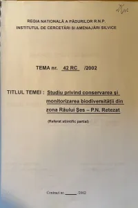
The data presented by this scientific study “clearly highlight the fact that the buffer zone of Retezat National Park, consisting of u.a. 1-101, includes virgin forests over a large area (1143.4 ha), and these forests, although composed of only 3 main species (spruce, fir, beech), display great diversity, represented by a notable number of forest ecosystem types.”….”After the central area of Retezat National Park, the buffer zone contains the most extensive virgin forests in the Retezat massif.”
The scientific study mentioned above also states the following: *“*The main economic activity taking place in the Râu Șes buffer zone of Retezat National Park is logging, quite intensive in recent years but localised, owing to limited accessibility, only in the lower third of the catchment, namely its left slope, in the section served by the road around the reservoir and partly along a stretch of the forest road. In u.a. 81A, B, 83A,B, 85A and particularly 89A, sanitary and conservation felling has begun and is ongoing, as well as strip clear-felling (in u.a. 94A), affecting biodiversity in the area, especially because such felling, begun after the adoption of the latest forest management plan, took place in old stands meeting all the criteria for inclusion in the category of “virgin and quasi-virgin forests” ” “In this regard, we consider it an error that the forest management plan prescribed strip clear-felling in this buffer zone, felling that has indeed taken place. A revision of the forest management plan is necessary, possibly even before the current decade of its application expires.”
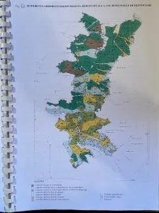
This scientific study also presents the Distribution of Stands in the Râul Șes Basin (u.a. 1-101) by Development Stages, a document we attach to this letter (see ANNEX 1_Distribution of stands Râu Șes)
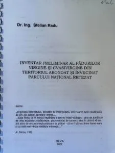
2.5.2 Compliance with the Preliminary Inventory of Virgin and Quasi-virgin Forests in the Territory Assigned to and Adjoining Retezat National Park, drawn up in Deva/2002, author Dr Eng. Stelian Radu
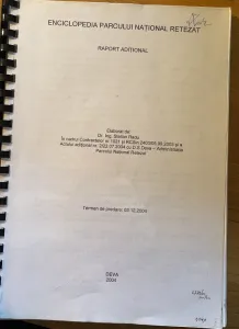
2.5.3 Compliance with the Encyclopaedia of Retezat National Park (Additional Report), prepared by Dr Eng. Stelian Radu/Deva/2004
2.5.4 Compliance with IUCN recommendations stating that forestry practices pose threats to freshwater habitats:
”The impact of forestry practice – both afforestation and deforestation – on freshwater habitats and fishes is a cause of much concern.”
https://www.iucnffsg.org/freshwater-fishes/major-threats/
2.5.5 Full compliance with the provisions of Art. 22 (paragraphs 1,2 and 4) of OUG 57/2007
Art. 22.
“(1) The internal zoning of protected natural areas of national interest is carried out through the management plan, by defining and delimiting, as appropriate: strict protection zones, integral protection zones, buffer zones and zones for the sustainable development of human activities.
(2) Strict protection zones are areas within protected natural areas of great scientific importance, encompassing both scientific reserves and wild areas where there has been no human intervention or its level has been very low.
(4) Integral protection zones encompass the most valuable natural heritage assets within protected natural areas.”
The current zoning proposed in the management plan does not reflect the actual situation on the ground. Entire wild, human-unaltered sub-catchments, with compact forest ecosystems over large areas unfragmented by roads and logging, have not been included in the national park’s non-intervention zone, but have instead been erroneously proposed as sustainable conservation zones. This erroneous classification will ultimately lead to the degradation and destruction of these habitats through logging, which would be permitted in these types of zone.
We have found that the national park’s non-intervention zone does not even include the forests already entered in the catalogue of virgin and quasi-virgin forests (see Annex 2, the Excel document attached to this letter), nor those with studies under way, as would be natural.
This violates the Protected Areas Law (L 49/2001 approving OUG 57/2007), which defines these zones:
Human-unaltered areas with forest ecosystems covering extensive areas, with virgin, quasi-virgin and centuries-old stands within national parks, fit exactly within strict or integral protection zones, being areas of great scientific importance, unaffected by human intervention, and the most valuable natural heritage assets!
Below, we provide 3 examples of forest sub-catchments erroneously classified as sustainable conservation zones in the management plan, although they should be classified as strict or integral protection zones:
- Râul Șes Valley is a compact forest ecosystem of great value and a genuine wilderness area linking the Godeanu Mountains with the Țarcu Mountains, with no forest road along the valley and numerous valuable centuries-old stands, a large proportion of which are virgin or quasi-virgin forests. In the lower part of the valley, several compartments were already logged and damaged during 2010-2013 under the pretext of bark beetle attacks. However, numerous abuses, illegal acts and breaches of forestry rules were committed, confirmed and sanctioned, and were also mentioned in the Romanian Academy’s report entitled: “Findings concerning logging in Retezat National Park”:
http://arhiva.replicahd.ro/?p=2246
The letters addressed to the Romanian Academy by Gheorghe Cionoiu and then by a number of environmental nongovernmental organisations led to the establishment of a study commission coordinated by Academician Victor Giurgiu, whose conclusions leave no room for doubt: “The operator harvested trees primarily on the basis of value, leaving weakened or drying trees standing (…) An almost total lack of supervision by staff from the two administrations was found (OS Retezat and the Retezat National Park Administration (…) The situation described resulted from the failure of specialist staff from OS Retezat and the Retezat National Park Administration to fulfil their duties (…) Even after the irregularities mentioned were reported in the media, the two bodies denied the reality and provided ‘reassuring’ information, on the basis of which the leadership of the Ministry of Environment and the National Forest Administration made unsupported public statements. The timely involvement of the Scientific Council of Retezat National Park and the Commission for the Protection of Natural Monuments would have been necessary”.
The valley’s wild character was also confirmed by the Scientific study under Research Topic No. 42RC/2002, carried out by the Forest Research and Management Institute within the Romsilva National Forest Administration, with the entire Râul Șes valley sub-catchment proposed for protection and 1143.4 ha of virgin and quasi-virgin forests identified in u.a. 1-101, some already damaged (u.a. 81A, 82A,B, 83A,B, 85A, 89A, 94A) by illegal logging, but with an appearance of legality provided by an erroneous forest management plan that did not reflect the actual situation on the ground.
Including this forest sub-catchment in the sustainable conservation zone in the next management plan has no scientific basis. Even the distribution maps for Natura 2000 protected species and habitats identify a very high density of such species and habitats in this sub-catchment, clearly requiring strict protection so that they are not affected. We firmly request strict protection for the entire sub-catchment of Râul Șes Valley.
- Lăpușnicul Mic and Borăscu Valley is another compact forest ecosystem of great value and a genuine wilderness area in the heart of the Godeanu Mountains, with no forest road along the valley and numerous valuable centuries-old stands, a large proportion of which are virgin or quasi-virgin forests. Recently, hundreds of hectares were identified in this forest sub-catchment too, following studies carried out by WWF:
Protecting only the upper part of these 2 wild valleys is not justified, since they form a compact forest ecosystem of great value that must be conserved in its entirety.
Including this forest sub-catchment in the sustainable conservation zone in the next management plan has no scientific basis. Even the distribution maps for Natura 2000 protected species and habitats identify a very high density of such species and habitats in this sub-catchment, clearly requiring strict protection so that they are not affected. We firmly request strict protection for the entire sub-catchment of the Lăpușnicul Mic and Borăscu valleys.
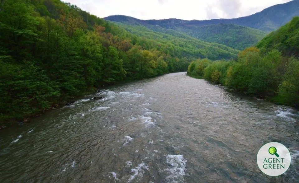
- Râul Alb and Vasielu Valley is another compact forest ecosystem of great value and a genuine wilderness area in the northeastern Retezat Mountains, with no forest road along the valley and numerous valuable centuries-old stands, a large proportion of which are virgin or quasi-virgin forests. Râul Alb, being the only ecologically complete and relatively unaltered river in the Romanian Carpathians, is clearly of great scientific importance, and protecting it depends on protecting the forest on the slopes. The portion of the Râul Alb basin within the national park is still a wild area where human intervention, consisting solely of illegal felling in recent years, remains at a low level. There are no buildings, standard forest roads or even a tourist trail in the Râul Alb basin. The scientific value of Râul Alb is certified by the scientific article “Dejeu C, Carpa R, Remizovschi A,Bond J. The widespread alteration of rivers in the Romanian Carpathians and the undisturbed Râul Alb. River Res Applic.2021;1–9. https://doi.org/10.1002/rra.3770” (see Annex 3_Scientific Article Râul Alb)
An essential element forgotten by the plan’s authors is that the integrity of the national park is already seriously affected by the destruction of watercourses through the construction of the Gura Apei dam and adjacent secondary water intakes. A river is like an organism: diverting its water at one point entails a serious deterioration of the river’s condition both upstream and downstream. Riparian habitats are also directly affected. We therefore already have a serious impairment of the national park’s integrity. Some of the intakes, such as the one on Paroș, were built and put into operation after the previous version of the management plan (now expired) was drawn up. Consequently, at least some compensation, as far as possible, is needed for this massive industrial assault on the park. We propose that this compensation consist of including all the forest in the park in the strict protection zone or the integral protection zone.
Studies are under way for numerous compartments in this valley with a view to including them in the catalogue of virgin and quasi-virgin forests, following the tender launched by MMAP:
A large proportion of the forests in this forest sub-catchment were also identified by the Pin-Matra study of 2005, demonstrating the extraordinary conservation and scientific value of this intact forest area, which must be protected in its entirety.
Including this forest sub-catchment in the sustainable conservation zone in the next management plan has no scientific basis. The virgin, quasi-virgin and centuries-old forests present here must be placed under strict or integral protection so that they are not affected and damaged. We firmly request strict protection for the entire sub-catchment of the Râul Alb and Vasielu valleys.
We also attach the list of compartments of potential virgin and quasi-virgin forests in Hunedoara County for which studies are being carried out by MMAP (Ministry of Environment, Waters and Forests), and which must be strictly protected by inclusion in the non-intervention zone, namely functional type T1.
We also attach to this letter the tender specifications document (Annex 4_Specifications for virgin forests), for which studies are already under way and which we insistently ask you to take into account when preparing management plans and forest management plans.
2.5.6 Compliance with the Pin Matra and PRIMOFARO studies.
The forests identified as “potentially” virgin, quasi-virgin or centuries-old have not been included in the strict or integral protection zone, whose purpose is non-intervention. All these forests fit the definition of the strict/integral protection zone laid down in Art. 22 (2), (4) of OUG57/2007, and the current zoning reveals major shortcomings in compliance with the law. The internal zoning must be completely redone.
2.5.7 Compliance with the purpose of the national park laid down in Annex 1 OUG57/2007.
The studies do not show why logging, established through the sustainable conservation zone, is necessary in a national park “…whose purposes are the protection and conservation of representative samples of the national biogeographical space…”. We note that OUG57/2007 does not require all 4 zones to be established.
2.5.8 Compliance with Law 2013/1998 concerning the legal status of land.
2.6 Correct and complete drafting of the document:
-
Reviewing the information presented in the plan. Data are presented incorrectly, without structure or ambiguously (e.g. two different areas for the same feature). Numerous tables do not follow the structure required by the guide.
-
Brief analysis of the drafting of the plan’s chapters. The shortcomings are major and require the plan to be completely redrafted, including some of the field studies:
-
GENERAL INFORMATION.
- 1. Summary description of the Management Plan. Tables containing relevant information are missing.
- 1.1. Principles of the Management Plan. This information is irrelevant and outside the structural framework of the management plan.
- 1.2. Purpose of the Management Plan. The national park’s purpose, namely ecosystem protection, is not reflected. The management plan is integrated and the strictest protection regime applies.
- 1.4. General objectives of the Management Plan. There are no relevant objectives for protecting the park’s ecosystems, centuries-old forests or wilderness areas.
- 2. Process of drafting the Management Plan. It is not clear who carried out the studies, what methods were used or what methodology was used to draw the internal zoning boundaries.
- 3.1. Protected natural areas covered by the Management Plan. The information in the table is not presented according to the mandatory structure. Two different area figures are presented, clearly indicating a lack of knowledge of the boundaries of the protected areas. As a consequence, the biodiversity studies, conservation-status assessment, assessment of the legal status of land and activity planning have been flawed. The expression *“*Area according to designation documents” reveals unfamiliarity with the usual terms used in the field. Designation is carried out through justification studies and legislative acts.
- 3.2. Location of protected natural areas covered by the Management Plan. The table required by the structure is missing; instead, other tables irrelevant to the section are presented, concerning access roads.
- 3.3. Boundaries of the protected natural area/areas covered by the Management Plan. This chapter does not exist, having been replaced by “1.3.3 Management resources and infrastructure”, which presents information not provided for in the structure established by the Ministerial Order.
- 3.4. Boundaries of protected natural areas covered by the Management Plan (equivalent to 1.3.3. Boundaries of the protected natural area/areas covered by the Management Plan — in the guide) provides no concrete information on the boundaries, the year, the legislative act establishing them, the justification study underlying their designation/delineation or their history. The reference to the Ministry of Environment’s website is unacceptable.
- 3.5. Internal zoning of the protected natural area should have been chapter 1.3.4. Internal zoning of the protected natural area. No relevant information is presented on the areas and percentages occupied or the share of ecosystem types in each zone. The Sustainable Development Zone must include only built-up areas, excluding semi-natural areas that could be restored to a natural state. The management plan is not drawn up on the basis of the PUG; it is the other way round, according to OUG57/2007. The text refers to several articles of legislative acts, breaching legislative drafting rules. Those articles may be repealed and are not relevant in the present text.
-
ABIOTIC ENVIRONMENT OF PROTECTED NATURAL AREAS
- 1. Geology
- 2. Hydrography. Glacial lakes, one of Retezat’s symbols and also a conservation objective, are presented extremely briefly, even with uncertainty as to their number. By contrast, the Gura Apelor Dam and the Râul Mare Retezat Hydropower Complex, which do not fall within the administration’s direct management, are presented in detail, although we appreciate this information. Groundwater is not addressed at all.
- 3. Soil science. Theoretical descriptions irrelevant to the territory concerned are presented, with no correlation between these soils and the vegetation/habitats/ecosystems.
- 4. Climate. All the data are general, taken from other works, and present nothing relevant about the microclimate, specific features of the catchments, glacial lakes, etc. The current information is of no use in management planning, for example in identifying areas vulnerable to natural disasters.
- 5. Abiotic features of conservation interest. This chapter has not been written; consequently, the planning of specific objectives, measures and actions does not address these features of particular importance for Retezat. How are glacial lakes, karst areas, caves, rocky areas, etc. protected?
-
BIOTIC ENVIRONMENT OF PROTECTED NATURAL AREAS
- 1. Ecosystems. The underground ecosystem is not addressed at all. A list of ecosystems and areas is insufficient for planning the national park’s management. From this chapter onwards, planning is flawed by a lack of knowledge of the details.
- 2. Habitats of conservation interest on the basis of which the protected natural area/areas were designated. Essential habitat characteristics are not presented (e.g. stand age, plant communities, natural areas, areas altered by logging, planting, etc.); Habitat 8310 Caves is not presented, although there is even a nature reserve in addition to other caves.
- 2.2. Habitats according to the national classification. The framework content of the table required by the guide is not followed (Table A. General data on the habitat type; Table B. Specific data on the habitat type within the protected natural area).
- 3. Flora and fauna species of conservation interest for which the protected natural area was designated. The framework content required by the guide is not followed: Table A. General data on the species; Table B. Specific data on the species within the protected natural area
- 3.1. Lower plants. The chapter is missing
- 3.2. Higher plants. It is incorrectly numbered as 3.3.1. Data are missing.
- 3.3. Invertebrates. It is incorrectly placed under 3.3.2 Invertebrates. Data are missing.
- 3.4. Fish fauna. It is incorrectly placed under 3.3.3 Fish fauna. Data are missing.
- 3.5. Herpetofauna. It is incorrectly placed under 3.3.4 Herpetofauna. Data are missing.
- 3.6. Bird fauna. It is incorrectly placed under 3.3.5 Bird fauna. Data are missing.
- 3.7. Mammals. It is incorrectly placed under 3.3.6 Mammals. Data are missing. We note as relevant the statement “Based on the information obtained from the documentation consulted, a general reconnaissance of environmental conditions favourable to the species in the study area was carried out, with the aim of obtaining direct, partial information on the actual situation in the field”, which reinforces our findings concerning the superficial field studies and the questionable accuracy of the data that flawed both the determination of conservation status and the planning of conservation measures.
- 4. Other flora and fauna species relevant to the protected natural area. Relevant information, such as the areas occupied, is missing.
-
SOCIOECONOMIC and CULTURAL INFORMATION
- 1. Local communities. The subchapter should be called “4.1. Local communities and stakeholders”
- 1.1 Demographic data on local communities. The data and the table List of administrative-territorial units within the protected natural area/areas are missing; Characterisation of administrative-territorial units; Population of settlements within the protected natural area; Population of settlements in the immediate vicinity of the protected natural area that are relevant in terms of human presence within the site (table incorrectly presented); Birth rate: live births per settlement for settlements within the protected natural area; Migration: new residents in settlements within the protected natural area; Public utilities; Animal numbers; Data on economic activities.
- 2. Stakeholders must be chapter 4.1.2. Stakeholders. The correct title, Summary table of the most important stakeholders active and involved in relation to the protected natural area, is not used. Stakeholder analysis I is superficial/incorrectly prepared, as each stakeholder must be analysed individually. All town halls or all County Councils cannot behave in the same way. It must be completely redone because even the table structure required by the Ministerial Order is not followed. The Stakeholder analysis II table does not follow the structure in the Ministerial Order, with information missing (Matters requiring attention; threats and problems)
- 2. Land use. The table structure in the Ministerial Order, “List of land-use types”, is not followed. The description of land use contains no information relevant to the protected area, but rather copied theoretical concepts.
- 3. Legal status of land. Archaic language, no longer in common use or falling out of use, is inappropriate for this document: “întăbulate, neîntăbulate”; we recommend using the current term “intabulat”. Lack of knowledge of ownership over more than 23% of the territory is a major obstacle to management. The Cadastre Office and the Land Register hold such data, and a specialist company can professionally prepare the cadastral record. The map of the legal status of land is presented in Annex 20 to the Management Plan. This map is inappropriate because it must reflect the boundaries of the ownership types shown in the table. The table *“*Land registration status” shows that 100% of the land is registered; consequently, data on ownership and use are available to complete the preceding table. This is a contradiction in the presentation of information, probably resulting from a lack of experience in planning and managing protected areas.
- 4. Administrators, managers and users. A description of the situation is missing. In the table “Information on administrators/managers”, the administration period is inexplicably presented as “unknown”. The information presented must be detailed for each legal entity separately, rather than collectively.
- 5. Infrastructure and buildings. A description of the subject is missing, as is all the information required by the guide: Types of buildings; Dwellings existing in the year . . . . . . . . . ., grouped by settlement; Building permits issued for buildings by building category, county and settlement, and applications for environmental endorsements/agreements.
- 6. Cultural heritage. This chapter is entirely missing.
- 7. Tourist attractions. All the information required by the guide is missing: Description of tourist attractions; Types of tourist attractions.
-
ACTIVITIES WITH A POTENTIAL IMPACT (PRESSURES AND THREATS) ON THE PROTECTED NATURAL AREA AND SPECIES AND HABITATS OF CONSERVATION INTEREST
- 1. List of activities with a potential impact. Descriptions and concrete information from the protected area are missing. For example, nowhere is major degradation described in concrete, quantified terms, namely the length of timber extraction tracks affected by erosion where the land has not been restored to its initial condition as required by the mandatory rules. This major soil degradation must be presented, mapped and addressed in soil and habitat restoration measures.
- 1.2. List of future threats with a potential impact within the protected natural area. Superficial information.
- 2. Maps of activities with a potential impact. Not all existing pressures and threats are addressed.
- 3. Assessment of impacts on species. The chapter is missing.
- 4. Assessment of impacts on habitat types. The chapter is missing.
-
ASSESSMENT OF THE CONSERVATION STATUS OF SPECIES AND HABITAT TYPES. The information presented throughout the chapter does not comply with the provisions of Ministerial Order 304/2018, and the content does not reflect real data. For this reason too, the following chapters are flawed and do not reflect the measures/actions/regulations needed for species, habitats and ecosystems.
- 1. Assessment of the conservation status of each species of conservation interest
- 1.1. Assessment of the species’ conservation status in terms of its population. The chapter and information required by the tables in the structure laid down in the Ministerial Order are missing.
- 1.2. Assessment of the species’ conservation status in terms of its habitat. The chapter and information required by the tables in the structure laid down in the Ministerial Order are missing.
- 1.3. Assessment of the species’ conservation status in terms of its prospects. The chapter and information required by the tables in the structure laid down in the Ministerial Order are missing.
- 1.4. Overall assessment of the species. The chapter and information required by the tables in the structure laid down in the Ministerial Order are missing.
- 2. Assessment of the conservation status of each habitat type of conservation interest
- 2.1. Assessment of the habitat type’s conservation status in terms of the area occupied by the habitat type. The chapter and information required by the tables in the structure laid down in the Ministerial Order are missing.
- 2.2. Assessment of the habitat type’s conservation status in terms of its structure and specific functions. The chapter and information required by the tables in the structure laid down in the Ministerial Order are missing.
- 2.3. Assessment of the habitat type’s conservation status in terms of its future prospects. The chapter and information required by the tables in the structure laid down in the Ministerial Order are missing.
- 2.4. Overall assessment of the habitat type’s conservation status. The chapter and information required by the tables in the structure laid down in the Ministerial Order are missing.
-
PURPOSE AND OBJECTIVES OF THE MANAGEMENT PLAN
- 1. Conservation and management of species and habitats of conservation interest in the Natura 2000 sites ROSCI0217 Retezat, ROSPA0084 Munții Retezat, Retezat National Park and the nature reserves included. This subchapter is incorrectly written. It should have been written as 7.1. Purpose of the Management Plan for the protected natural area. It does not contain the “ecosystem” element specific to the national park.
- 2. General objectives, general measures, specific/management measures and activities
- 2.1. General objective. The chapter in the guide’s format is missing.
- 2.2. Specific objective. The chapter in the guide’s format is missing
- 2.3. Specific measure/management measure. Given the major shortcomings in the preceding chapters and the need to redraft the plan, a qualitative and quantitative analysis of the proposed measures is not justified. As an example, we note that the measures stated for forests are in fact rules, copied provisions and the establishment of indicators characteristic of natural regeneration and forestry activity; the actual conservation measures for which the integrated management plan is being prepared are missing. For the drafting of the management plan, we recommend contracting experts in conservation, in addition to forestry experts.
-
ACTIVITY PLAN AND RESOURCE ESTIMATE
- 1. Activity plan. The table format is not followed (the “partner” column). Planning must be redone after the preceding chapters have been redrafted.
- 2. Estimate of resources needed. The chapter is missing.
-
ACTIVITY MONITORING PLAN
- 1. Periodic reporting
- 2. Tracking planned activities. The chapter is missing.
- 3. Indicating the activity carried out
-
BIBLIOGRAPHY AND REFERENCES. The bibliography, incorrectly placed as an annex, is missing. The annexes and maps do not follow the guide precisely.
2.7 Other shortcomings:
-
Objectives must be formulated as SMART! S — specific, M — measurable, A — attainable/approachable, R — relevant, T — time-bound. At present, the wording is defective, inconsistent and does not conform to the way an objective should be formulated.
-
Measures and activities must be linked to the specific and general objectives.
-
Quantification indicators must contain the numerical expression of the concrete indicator for the action. The current wording is deficient.
-
Compliance with Annex 1 on national parks in OUG57/2007. The document’s current form reveals a lack of vision and of theoretical and practical knowledge of protected areas. The essential, mandatory and strategic elements of the management plan arising from European directives, national legislation, national strategies and the particular features of the protected areas are not highlighted:
-
National parks are those protected natural areas whose purposes are the protection and conservation of representative samples of the national biogeographical space, encompassing natural features of outstanding value in physical-geographical, botanical, faunal, hydrological, geological, palaeontological, speleological, soil-related or other terms, allowing visits for scientific, educational, recreational and tourism purposes. The management of national parks ensures the maintenance of the physical-geographical setting in its natural condition, the protection of ecosystems, the conservation of genetic resources and biological diversity under conditions of ecological stability, the prevention and exclusion of any form of exploitation of natural resources and land uses incompatible with the assigned purpose. The management regime is established through their own protection and conservation regulations and plans, approved by the competent national scientific and administrative authorities in accordance with the provisions of this emergency ordinance. Their boundaries shall encompass terrestrial and aquatic ecosystems or portions of ecosystems influenced as little as possible by human activities. Features of outstanding value within national parks may be delineated and placed under a strict protection regime as scientific reserves. National parks generally cover large areas of land. Within national parks, only traditional activities practised solely by communities in the national park area are permitted, and these traditional activities shall be regulated through the management plan. National parks correspond to IUCN category II, “National park: protected area managed mainly for ecosystem protection and recreation”.
-
Sites of Community importance are those protected natural areas that, in the biogeographical region or regions in which they occur, contribute significantly to maintaining or restoring natural habitats or species of Community interest to a favourable conservation status.
-
Special protection areas for birds are those protected natural areas whose “purposes are the conservation, maintenance and, where appropriate, restoration to a favourable conservation status of bird species and specific habitats, designated for the protection of wild migratory bird species”.
-
There are no measures concerning the management of ecosystems — terrestrial, aquatic and underground; virgin, quasi-virgin and centuries-old forests; endemic species, karst features, scientific reserves and nature reserves.
-
There are no measures concerning guarding, surveillance and combating illegal activities; the discharge of polluted water into receiving watercourses; preventing grassland and forest fires; restoring habitats.
-
There are no measures concerning tourism and recreational development. On the contrary, rules are provided that are intended to block low-impact tourism activities.
-
Compliance with Law 500/2002 concerning the preparation of the multiannual budget. No budget has been prepared to finance actions in accordance with Order 304/2018.
-
Compliance with the rules for drafting the entire management plan and preparing maps (written and drawn parts). These rules have been breached; consequently, the plan requires complete redrafting.
-
OUG57/2007 on the regime of protected natural areas and the conservation of natural habitats and of wild flora and fauna.
-
Order 304/2018, Guide for drafting management plans for protected natural areas, of 02.04.2018
-
Law No. 8/1996 on copyright and related rights.
-
Law No. 24/2000 on legislative drafting rules for preparing legislative acts.
-
The INSPIRE Directive, Ordinance No. 4/2010 establishing the National Infrastructure for Spatial Information in Romania,
-
Law No. 7/1996 on cadastre and land registration, as subsequently amended,
-
Emergency Ordinance No. 49/2016 amending Law No. 5/2000 approving the National Spatial Development Plan — Section III — protected areas. At present, these legislative acts are being breached.
-
The Regulations have structural and conceptual shortcomings, breaching the rules in force. The Regulations must be completely rewritten. The Regulations must present only a set of rules resulting from the information analysed in the management plan and intended to limit/penalise activities that may degrade species, habitats or ecosystems, or to establish standards of conduct to prevent damage. Some examples of errors:
- Article 1 incorrectly refers to historical data, the administration contract and information about the legal entity currently administering the area. Historical data are found in the Management Plan, while information about the administrator is found in the administration contract and other legislative acts.
- Article 2, 3 refers to legislative acts (which are not rules) and provisions from them (which have already been laid down in a legislative act and would breach legislative drafting rules).
- Article 4 refers to the existence of a map. It is not a rule.
- Article 5 refers to and lists provisions of OUG57/2007. Since the Management Plan and the Regulations are approved by a legislative act (Ministerial Order), Law No. 24/2000 does not permit the same rule to be transposed into two legislative acts. We recommend consulting an experienced lawyer.
3 Annexes
ANNEX 1_ Distribution of Stands in the Râul Șes Basin
3.2 ANNEX 2_catalogue of virgin and quasi-virgin forests 16 November 2020
ANNEX 2_catalogue of virgin and quasi-virgin forests 16 November 2020
ANNEX 3_Scientific Article Râul Alb_
Dejeu C, Carpa R, Remizovschi A,Bond J. The widespread alteration of rivers in the Romanian Carpathians and the undisturbed Râul Alb. River Res Applic.2021;1–9. https://doi.org/10.1002/rra.3770
ANNEX 3_Scientific Article Râul Alb (PDF, in English)
ANNEX 4_Specifications-virgin-forests
ANNEX 4_Specifications-virgin-forests (PDF, in Romanian)
We look forward to receiving your written response at the email addresses office@agentgreen.org and contact@tarcu.ro
We also look forward to receiving a registration number for this Letter.
Yours sincerely,
Asociația Agent Green Asociația Altitudine Călin Dejeu
Gabriel Păun Alexandru Teleagă Biologist and environmental activist
President